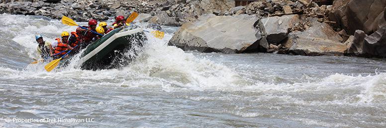
If you are traveling with children or first-time visitors, nature lovers, honeymooners or those are interested in learning River kayaking, we recommend you Seti River for short rafting trip in Nepal. It is one of the most beautiful and pristine rivers. You will get lots of fun while rafting in several rapids. It passes through two beautiful and contrasting scenic spots that give a good variety of Nepal’s landscapes with local villages, terraced rice fields, waterfalls, suspension bridges, jungle rich with wildlife and a beautiful white sandy beach. Seti River Rafting is a popular choice for winter trips and also for kayak clinics for the beginners. After completing the rafting adventure trip, you have a choice either to get back to Kathmandu or continue a journey to visit Chitwan National Park or go for trekking in the popular area of Annapurna region for a few days.
From Kathmandu it is 5 hours’ drive to reach Damauli bazaar, river put in point and begins rafting. The distance we cover during rafting is about 35 km and we can enjoy rafting adventure for 2 days. March-April and October are considered to be the best time for Seti River Rafting.
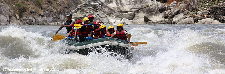
Arun is a beautiful river in Nepal that rises from Tibet and its major tributary flows towards the Saptakoshi River on its way onto the Indian plains in Bihar. Along the route, the Arun runs through mesmerizing mountain scenery, remote area villages and farming valleys. At its peak flow in some places, Arun River truly rages with class VI rapids. In other places, it meanders along at a more moderate pace allowing you time for relaxation and to enjoy your pristine natural surroundings. Arun River provides nearly 38% of water to the Sapta Koshi River.
Due to Arun’s remoteness getting there is a part of the action. To reach the river put in point one has to travel the 500 km over two days by road or fly to Tumlingtar airstrip. From Tumlingtar it is four hours trek to Kartikeghat, put in point of the river. Though difficult to reach, it is certainly one of the most rewarding river rafting trips in Nepal. While rafting, the powerful current drives your raft through 6 days of great whitewater action and you will face more challenges each day as the number of rapids approaches one after another in succession; at night you relax on fantastic beaches in the valleys. The combination of trekking, spectacular scenery, great rapids and remote location makes Arun the best river to run the fantastic white water rafting trip in Nepal. The best time for Arun River Rafting is Autumn & Spring season.
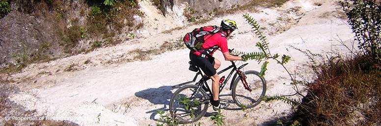
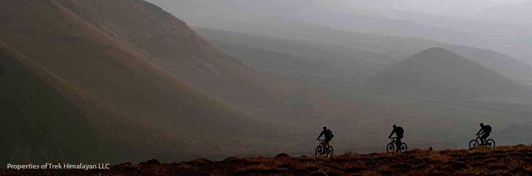
This is the easy and relaxing mountain biking tour around the hills of Kathmandu valley. This fascination bicycle ride takes you to rarely visited rural areas of Nepal and is perfect for those looking to combine the fun and ‘Soft’ adventure through the lower hills with spectacular views of Kathmandu valley and Himalayan Mountains in the distance.
You will cycle at your own pace on peaceful country trails with frequent stops at the very popular historical and medieval places of Bhaktapur and Patan and beautiful villages of Chisopani and Bhungamati for your meals and overnight stay. This is the only way to explore the rural Nepal. During the cycling tour, you will also have an opportunity to interact with the local people, visit the historical shrines and experience the lifestyle and cultural aspects of people. En-route you will visit the medieval city of Bhaktapur and Patan and their surrounding areas.
From Nagarkot, you will see great views of Himalayan Mountains that includes Mt. Everest, Mt. Annapurna, Mt. Manaslu, Mt. Langtang, and Mt. Ganesh Himal. Cycling uphill and downhill gives you a thrilling experience of a lifetime.
You will stop by Hattiban Resort for lunch. This resort is located in the natural setting amidst the forest providing guests a secluded hideaway from their hectic city life. In the resort, you will spend a couple of hours and then proceed to Dakshinkali Temple. It is a popular Hindu pilgrimage site situated at the confluence of two sacred streams in a rocky cleft in the forest.This temple is dedicated to the goddess Kali. At Dakshinkali your mountain biking tour comes to an end and next day you will be transferred to Kathmandu in our private vehicle. Soft Bike Tour is a fun-filled trip and suitable to every mountain biker of any age group.
For further queries about the trip and regular departures, please contact us at info@trekhimalayan.com.np
Kharta Valley is a remote region along with Mt. Everest which consists of the Himalayan ranges of Everest region and the arid Tibetan plateau. The Kharta Valley trek starts from Kharta valley 370 km southeast from Shigatse taking us to pristine wilderness, beautiful Alpine Lakes and beautiful mountain views. On the way, we can enjoy the magical views of Mt. Makalu, Mt. Everest, Pethangtse, Lhotse, and others. We spend several days in a spectacular high-altitude meadow, exploring, relaxing and snapping pictures. This trek is a magical combination of high alpine villages, spectacular Himalayan views, high altitude alpine flowers and Tibetan heritages. You will also see some nomads with yaks roam the plateaus.
Kharta Valley Trek with Everest Base Camp begins from Kathmandu with a flight to Lhasa. This scenic flight journey offers great views of the world’s highest mountain, Mt. Everest, third highest mountain, Kangchenjunga and many other peaks. Upon arrival in Lhasa airport, you will be transferred to Lhasa city where you will stay two nights to acclimatize. During your stay in Lhasa, we will organize sightseeing tour. For the trekking, we will take you to the nomadic zone in Tibet called “Kharta valley”. This is the remote area trekking in Tibet, where you can feel the unexplored beauty of this virgin land. During the trek, you will walk through Shawu Tso, cross Shawu La pass, Joksham, Thangsum and ends in Everest Base Camp. Then we will take you back to Lhasa and from Lhasa, we will fly back to Kathmandu or you may travel to mainland cities of China and make a departure to your home country. This trek is ideal for any adventurous travelers and trekking enthusiasts who have a good level of fitness and interest in visiting the remote corners of the world as well as Everest Base Camp in Tibet.
Kathmandu valley rim gives a good choice for mountain biking tour in Nepal. You will ride out on the valley rim to explore traditional Newari villages, monasteries, temples, national park and experience the daily chores of local Nepalese people in the villages.
Within a couple of hours of riding, you will reach the high points of the rim to view spectacular Himalayan mountain range. From Nagarkot and Chisapani the views of Ganesh Himal, Langtang, Annapurna and Everest are breathtakingly fantastic.
After leaving Kathmandu city, you will start your biking journey on a busy traffic trail before heading to Kakani and stay overnight at a local lodge. Next day you will continue your bicycle tour following the trail the rocky uphill ascent before riding on a smooth trail passing through Mulkharka and Chisapani villages. During the ride, you will enjoy some of the best scenic views that include the towering high mountains and the beautiful Kathmandu valley. Leaving Chisapani you make the downhill ride all the way towards Nagarkot. After arriving at this lovely place you will visit the view tower of Nagarkot and enjoy the sunset view and Himalayan panorama. From Nagarkot, you will continue your journey making downhill ride towards Dhulikhel. After spending one night in Dhulikhel, you will ride along the dirt trail leading to the Buddhist temple of Namobuddha. From Namobuddha you can have great views of mountain ranges that lie between Ganesh Himal and Everest. With mostly downhill riding from Namobuddha you will make a journey towards Balthali village where you will experience the culture and tradition of the local village and its surrounding areas. Leaving Balthali you will again follow a dirt trail to Panauti town and then make a gradual uphill climb towards Lakhure Bhanjyang. From there you will ride mostly downhill to Lubhu and then towards the Botanical Garden of Godawari. During your mountain biking journey you will follow the cultural village trails and explore some of the oldest towns of Kathmandu valley Kathmandu Valley Biking Tour with Trek Himalayan ends with a scenic ride back to Kathmandu city.
This is a unique experience you will ever enjoy. It will be a great fun and lifetime experience for both serious and recreational riders.
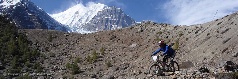
This is specially designed mountain biking tour program that takes you to Nepal’s most famous Upper Mustang region. Situated northwest of the country – Mustang region was opened for travelers only after 1992. Recent road construction in the region has made Mountain Biking tour much easier. Here you will explore arid, high deserts inhabited mostly by people of Tibetan stock. The men folks are either traders or farmers while the women mostly tend the fields. Besides, you will get into insights into the everyday lives of the mountain people of “Lo” where will have the opportunity to witness their vibrant culture and also get insight into Lama Buddhism so little changed by time.
The trip to this magical land begins at Jomsom, following an overland journey from Kathmandu to Pokhara. You will start the ride to a ruined citadel town- Kagbeni that guards the entrance into Upper Mustang. Entering Upper Mustang area, you will visit the 16th-century monastery at Charang, the fortress city of Lo-Manthang and Tibetan people dominated villages of Chaile, Syangboche, and others. Here you will observe the splendor and traditions of old Tibet. On your return journey from Upper Mustang, you will ride through the downhill trail to Pokhara via Ghorepani, Tadapani, Ghandruk and get back to Kathmandu by overland.
Upper Mustang Biking Tour is a perfect choice for keen mountain biking enthusiasts to explore one of the most remote regions in Nepal that include truly natural wonders, breathtaking valleys and ancient trading routes used mainly for trade connecting Nepal and Tibet.
Please free to contact us at info@trekhimalayan.com.np for the tailor-made and customized itinerary for any Biking Tours in Nepal. We will design with the itinerary as per your suggestion, the length of stay and budget.
Kangshung Valley, named after the glacier, is one of the most remote trekking destinations in central Tibet. The trail leads us across remote tiny pristine valleys dotted with beautiful lakes, alpine grazing pastures, and flowered meadows, with an excellent camping spot. While trekking we will enjoy stunning views of Mt. Makalu, Mt. Lhotse, Mt. Kangchenjunga and Mt. Everest Kangshung face. We begin Kangshung Valley Trek with a scenic flight from Kathmandu to Lhasa in Tibet, a sacred land of myths and mysteries. We spend 2 nights in Lhasa acclimatizing and exploring the sights and sounds of Lhasa city locked away in its mountains region.
After 2 days’ stay in Lhasa, we continue our trip overland to Kharta village via Gyantse and Shigatse to begin our trek. From Kharta village we head for Lhundrubling, cross Shao La (4970m), explore the forested Karma Valley & trek to the base camp at Pethang Ringmo. Then, we keep going exploring Kangshung Valley, Kangshung Base Camp (5090m) and other remote area places of Tibet. From a high ridge point above the Pethang camp, we enjoy stunning views of the Kangshung Face of Everest. The Kangshung Valley roars with the summer monsoon, the snow that accumulates daily on the peaks starts rumbling at noon and continues to fall noisily throughout the most nights.
On completion of the Kangshung Valley Trek at Kharta, we drive to Shegar and hike Rongbuk valley for views of the north face of Everest and visit Rongbuk Monastery. We explore Everest Base Camp and follow the same route until we reach Lhasa. From Lhasa, we catch a flight back to Kathmandu or continue our journey to the mainland cities in China.
Annapurna Half Circuit Biking Tour is the most scenic mountain biking tour which can be completed in 14 days. The trip begins from Kathmandu to Besisahar and heads along the rural trails of Manang and western part of Annapurna region. Pedaling through the fertile middle hills, various villages and diverse terrain of the two major river valleys (the Kali Gandaki and the Marsyangdi) is a lifetime experience. This trip involves both adventure activity and exploration of Annapurna region.
En route you will cross the highest mountain pass- Thorong La (5416 m) and ride down onto a jeep track up to Jomsom with thrill and excitement. Next morning you will fly from Jomsom to Pokhara. While riding along Kali Gandaki valley, you will visit all the popular places of Annapurna region like Jomsom, Kagbeni, and Muktinath. During the mountain biking tour, you will explore the lush sub-tropical rainforest, deep valleys, desert like trans-Himalayan landscapes, diverse culture, lifestyle and traditional houses of the local people. As you gain the elevation, you will experience changes in vegetations along the trails. The views of all places you observe through are truly fantastic.
This tour is recommended only for professional bikers with a strong heart and physically sound health. The best season for Annapurna Half Circuit Biking Tour is throughout the year except in monsoon season.

Mt Chekijo Peak Climbing is one of the least climbed trekking peaks in Nepal. It is located at the elevation of 6,257meters above sea level in the Gaurishankar mountain region in Dolkaha district. The recognized route for trekking is Shigati -Simigaon-Beding- Chekigo Base Camp and ascends the summit. We follow the trails that undulate between ridge and river-crossings past ancient rhododendron, oak and pine forests interspersed with terraced fields adjoining the numerous villages of the Rolwaling region. Many suspension bridges across gorges help shorten the climb. Views of magnificent peaks entertain us all the time along the trails. After Beding we reach the last settlement of the Rolwaling valley, it is simply a summer pasture locally called Kharka of Na village. At Beding we spend one extra day for acclimatization and exploration spectacular glacier and terminal moraine.
The climbing permit for Mt Chekijo was first granted in 2002 and since then Mt Chekijo has had few attempts less than 100 till this date. Bruce Normand from the United Kingdom and Oliver Von Rotz from Switzerland were the first to climb Chekijo peak in the year 2005.
If anyone is interested in climbing Chekijo peak or interested to know more information about it, please feel free to contact us info@trekhimalayan.com

Ramdung Peak (5,925 m), also known as the Ramdung Go peak, has become a popular trekking peak in the Rolwaling region. It offers superb Himalayan scenery including the Mount Gaurishanker, Dorje Lakpa, Chobabhamre, Tibetan Himalayan views. Ramdung Peak 5925m is situated south of Na in the upper Rolwaling region. Ramdung peak climbing is one of a cluster of peaks surrounding the Yalung La which provides access to upper Rolwaling from the south via the Khare Khola. A Scottish expedition team led by Bill Murray first climbed the peak in 1952. Then, in 1955 the Merseyside expedition team ascended the peak. Since then Ramdung has been an ideal peak for those wanting to trek and climb in the least explored Rolwaling Himal area.
The mountain trail is straight forward. From the summit, you can see the stunning and panoramic views from Langtang to Everest. It also provides magnificent views of Menlugtse and Gauri Shankar.
Ramdung peak is not very high. But, the route from Na covers a good distance and it requires two high camps before the summit. The camp 1 is set up at 4900 meters beneath the Yalung La. Climbing towards the pass and the snow camp 2 is placed on the broad glacier slopes east of the pass. We can also climb the slopes of the Ramdung Glacier via southwest of the additional peak onto a saddle at the junction along with the Yalung Glacier (5,650m). From here it takes about 4 and a half hour to climb summit to the top.
Parchamo Peak Climbing is a popular peak-climbing destination in the Everest region of Nepal. Situated in the Rolwaling Valley, Parchamo Peak stands 6,273 meters (20,574 feet) above sea level. Climbing Parchamo Peak requires technical expertise and experience in mountaineering. The ascent involves crossing glacial terrain, steep slopes, and potentially challenging weather conditions. Thus, it is recommended for experienced climbers or those who have undergone proper training and acclimatization.
Parchamo Peak, also called Parchemuche in Sherpa dialect, is located south of the Tasi Lapcha high pass (5,755m/18,875ft) along Rolwaling Himalayan range. When we view from the pass, this snow-clad peak looks quite attractive but straightforward with a well defined north-to-north west ridge rising from the relatively flat, crevassed glacier astride the Tasi Lapcha. To the west of the ridge, the face forms a consistent snow slope broken by crevasses and small seracs rising from the rocky lower buttresses above the Drolambau Glacier. At the base of Pharchamo Peak, one can see the glacier slowly moving. From the top of the peak, one can enjoy the panoramic views of Cho-Oyu, Amadablam, Thamserku, Kusum Kanguru and other surrounding Himalayan mountain peaks.
Parchamo Peak has become a climbing destination for many trekkers after crossing the high Tasi Lapcha pass and continue trek to Namche Bazaar in the Everest region. The Pharchamo Peak climbing can be combined with the more demanding Ramdung Go peak along with trekking over the Tasi Lapcha. While trekking one passes through the alpine vegetation and experience nice and cool climate.
This beautiful and snowy summit of Parchamo Peak was first climbed in the year 1955 by Dennis Davis and Phil Boultbee who were members of Merseyside Himalayan Expedition led by Alf Gregory. On Parchamo Peak trip one will explore two popular Himalayan trekking regions of Nepal – the non-touristry Rolwaling region and the iconic Everest region.
Ganden – Samye is one of the most popular treks in Central Tibet. Both these places are situated 45 km east of Lhasa to the south bank of the Kyi Chu to Medro Gongkar. This trek is a most pleasant for nature, culture and adventure enthusiasts. The trail passes through lakes, high snowy passes, and mountains, lush alpine meadows, nomads’ tents, Tibetan settlements, sacred sites, in the end culminating at the barren, desert-like surroundings near the Samye Monastery (3540m). Samye is Tibet’s first monastery founded in Tibet during the reign of King Trison Deutsen.
The Ganden Monastery is perched on a ridge-Gokyo Ri, which was chosen by Tsong Khapa for his meditation. This monastery is considered one of the greatest amongst the other six monasteries which belong to Gelukpa Sect. Ganden to Samye trek links two of the most important monasteries in Central Tibet and the trail crosses the Yatro Drak range of mountains that divide the Tsangpo basin and the Lhasa Valley. The trek provides superb and pristine scenery along with access to Tibet’s first monastery. The best time for this trek is from May to Mid of Oct. Trek Himalayan highly recommends Ganden – Samye trek only for those who have experience in hiking and camping in higher-elevation wildernesses.
Larkya Peak (6,249m) is located in the Manaslu Himal in the western part of Nepal. It is a least climbed trekking peak till this date and permits have only been started issuing to climb this peak since 2002. It is more challenging climbing peak involving higher level ice and glacier climb. Larkya Peak climbing requires one more camp beyond base camp (total two climbing days). From the top of Larkya peak, you can enjoy panoramic views of Himalayan peaks such as Manaslu, Himlung Himal, Ganesh Himal, Annapurna, and other Tibetan mountain ranges etc. The total length of the climbing expedition is of three weeks from starting to ending in Kathmandu.
The trail continues northward passing through many villages of the Tibetan origin. These villages offer an opportunity to explore their Tibetan customs and cultures and you can visit monasteries and observe prayer flags, prayer wheels and prayer walls over there.
Yala Peak is one of the popular non-technical trekking peaks located in the Langtang region of Nepal. Yala Peak Climbing is one of Nepal’s easier peaks and is often climbed along with its neighbor – Naya Kanga Peak. From the summit of Yala Peak, one can enjoy spectacular views of Langtang Lirung, Lenpo Gang, Dorje Lakpa (6966m) and the mighty Shishapangma (8013m) (Tibet side) which is made up of three sister peaks quite similar in elevation with two pinnacles to the northwest of the main peak. From the summit, one can see some amazing views of Tibet as well.
Yala peak is categorized as Grade easy as per the Alpine Grading system. However, this grade can vary from place to place depending on snow conditions. The peak is seldom climbed or is used as a warm-up for Naya Kanga towering on the opposite side of the Langtang valley. If you are lucky with the weather, the summit offers grand views of Mount Shishapangma. This peak would be a most suitable for a “first-time” climber in the Himalayas. It offers both adventure trekking and peak climbing in the Langtang region within a limited amount of time. The route involves a base camp at the end of the trail and a high camp a further half day’s trek beyond base camp. Prior climbing experience is not necessary to summit Yala peak but a reasonably good level of fitness is a must.
From Kathmandu, we begin our trip to Yala peak with a 8- hr long drive to Syabrubesi in the Langtang region. Next day we walk through a dense forest and traditional settlements via the Lama hotel, Langtang village, and Kenjin Gompa, until we reach the base camp of Yala peak. After summiting the peak we walk down to Syabrubesi and drive back to Kathmandu.

Paldor Peak (5,896m) lies in a remote area of the Langtang region at the southeast end of the Ganesh Himal. This area offers excellent walking trails for climbers and trekkers alike. The trails join Tiru and Karpu ridge at the head of the Mailung Khola, a tributary of the Trishuli Gandaki River. Paldor Peak Climbing can be climbed either via the North East, South East, West and South West Ridge. Paldor Peak was first climbed by Bill Tilman, Peter Lloyd, Tenzing Sherpa and Da Namgyal in 1949 through the North-East Ridge. The first ascent of South – East Ridge was made by John Cleare and Ian Howell in 1974. This route climbs along the long snow and ice arête that goes down to the fine rock peak of fang.
While trekking, you will catch a glimpse of stunning tranquil lakes, beautiful waterfalls, great Himalayan landscapes and lush green farming terraces. You also get an insight into the lifestyle and culture of the local indigenous communities.
The normal route to Paldor peak is via Sabrubensi close to Dunche in the Trisuli valley which can be approached in a 6 to 7 hours drive from Kathmandu. From Sabrubensi we begin the trek crossing the Bhote Kosi river way up to Tangjet and Gatlang villages, then we head to northward along the ridge before descending into the forest above Mailung khola.. The moraine filled valley below Paldor is reached from here. After summiting Paldor peak, we trek downhill to Sybrubensi in 4 or 5 days and take a land transport back to Kathmandu.
Chukkhung RI is a rocky peak like Kala Pattar. It is located above Chukhung village in the Khumbu region at the elevation of 5,550 meters (18,209 ft). For those seeking a longer trek and peak climbing at the same time, we offer this adventurous trip in the Everest region. We begin the trip after taking a flight from Kathmandu to Lukla and walk to Phakding. We gently climb up the Dudh Kosi river valley, crossing narrow suspension bridges which sway above the river’s thundering rapids, towards Namche Bazaar. We then leave the main trails and head up to the beautiful glaciated and turquoise blue lakes in the remote and beautiful Gokyo valley.
There, we make a non-technical climb to the top of Gokyo Ri (17,500′) which provides us a unique vantage point for viewing the magnificent south and north face of Everest, and its sister mountains such as Lhotse, Makalu, and Cho Oyu. We then cross into the Khumbu Valley towards Everest base camp, over the daunting Cho La Pass. Our next destination is Kala Patthar, a rocky summit with outstanding views of both Everest and the Khumbu Icefall. We continue our walk down the Khumbu valley through lively Sherpa villages and their traditionally- built stone houses, beautifully carved mani stones, sacred chortens and prayer flags fluttering in the wind. As you make entry into the Lhotse Valley, you’ll find yourself in the sleepy settlement of Chukung. From there you will hike to the top of Chukung Ri (19,000′), a non-technical walk up on a well-defined trail. The impressive views of the South Wall of Mount Lhotse and its surrounding Himalayan scenario make Chukhung RI one of the great trekking peaks in the world.
Abi Peak is one of the beautiful trekking peaks, located in the Mahalangur Himalayan range of the Upper Khumbu region. It is a rocky peak just South of Lobuche East. Mt. Abi, previously called‘. Cholo’ has been opened for climbing with a climbing permit. The summit can be approached through Kangchung La Pass. Those mountaineers planning to undertake 8,000m peaks in the Everest region consider Mt Abi to be a perfect training ground for ice climbing and high altitude acclimatization.
In addition, Abi Peak trip also includes a hike up to Gokyo-Ri to enjoy breathtaking views of Mt. Everest, Mt. Lhotse, Mt. Makalu, Mt. Cho Oyu and other surrounding peaks. After Abi Peak summit we trek down towards the crossing of one of a most popular but challenging Pass called Cho La at 5420 meters on our return journey. We follow the trail that passes through Pheriche, Tengboche, Namche Bazaar and then ends in Lukla.
Being technically difficult peak, Mount Abi requires a careful ascent to the summit. The summit ridge is narrow and can only be scaled the top in good weather condition. We require approx 200m of fixed ropes and other essential climbing gear. The rate of success to the summit is also high and Trek Himalayan proposed itinerary assures you proper acclimatization.
This peak was first issued a climbing permit in the year 2002. Since then it has been successfully climbed more than 15 times. We follow the normal route from Lukla through a forest filled with rhododendron trees towards Namche Bazaar and then up to Gokyo valley. Trek Himalayan provides all necessary logistics to assist in summit attempt. We organize permits, camp facilities, high-quality tents for base camp and high camp, fixed ropes, high altitude food, porters, professional climbing Sherpa, transport etc.
Pokalde peak climbing is one of the easy trekking peaks for climbing in the Everest region, which can be combined with Everest base camp trekking. From Lobuche the peak looks interesting but from Pheriche it looks an ordinary mountain rising to the south of Kongma La (5,535m.).
The summit of the peak provides a good view point for the panoramic views of the Everest Himalayas. This mountain was first climbed in 1953 by a route from the Kongma La along its North-ridge. Despite its relatively low altitude the mountain’s first successful climbers were giants of mountaineering. We climb to a rocky pass and follow beautiful snow ridge and cross rocky pinnacles. We then continue following the ridge to a little more difficult climb through stones and finally to the narrow rocky summit.
The North East Face of the mountain from east of Kongma La could be the easiest way to get to the summit of the Pokalde peak. We climb up through broken rocks and snow to the summit ridge and then to the summit. We could have chance to explore the Chhukung valley and others Himalayan range of khumbu region
Ombigaichan (6340m) is a rarely climbing peak in Mahalangur Himalayan range of the Everest region. It is approximately 2.4 km away from Mount Ama Dablam. It is the well-hidden peak and the approach is not easy, although it is located along the famous Everest base camp trekking route. The climbing permit was first issued in 2002. The normal route to Ombigaichan Base Camp begins at Lukla and follows Namche Bazaar up to Ama Dablam base camp. From this base camp, we reach the base camp of Mt. Ombigaichen for climb and summit. Those trekkers who have a passion for climbing and in good physical condition can easily set their foot onto the top with the support of our Sherpa climber. The natural treasure of the Everest region is extremely rewarding.
The rhododendron forests that bloom in Spring, traditional villages of Sherpa community, lush meadows, roaring river, glacial lakes, and Buddhist monasteries add extra charm to this region and make one of the best destinations to explore. From the summit of Ombigaichan, one can enjoy the panoramic view of the Himalayan mountain range that includes Everest, Lhotse, Nuptse, Makalu, Baruntse, Ama Dablam and many other peaks. The best season for Ombigaichen peak climbing is from March to May in spring and September to December in autumn. For more information, please contact us.
Standing at the elevation of 6159m/ 20,206ft, Nirekha Peak is one of the newly opened trekking peaks in the Mahalangur Himal of the Everest region. It is located between the Abi Himal and Lobuche West nearby the popular giants such as Everest (8,848m), Cho Oyo (8,188 m) and Chola-Tse Peak. It is one of the most popular viewpoints of all the peaks of Nepal. From the summit, one can enjoy 360-degree panoramic views of many Himalayan peaks all around.
We take an early flight to Lukla and then trek to Namche Bazaar same day. In Namche Bazaar we spend one extra day to acclimatize and do side excursion. After walking around 16.4 km we reach Gokyo where we spend one extra day. Here we climb to Gokyo Ri (Peak) and continue our trek to Nirekha Base Camp. Here we prepare everything and climb to High Camp and summit the peak.
The beauty of this high endless sea of rugged rock and ice pinnacles lure many climbers and trekkers alike from all over the world each year. Anyone can climb straightforward to the top of Nirekha Peak. The route to the summit is accessible via north of the Cho La Pass. However, one should be in good shape and have a passion for adventure. Climbing this peak requires some technical skills of peak climbing along with Ice-axe, Ice screw, crampons and some fixed rope. Trek Himalayan has organized Nirekha Peak climbing for quite a few people with the support of our experienced Sherpa climbers for the past two years and it was quite successful.
Kyajo Ri (6186 m) is the highest trekking peak on the southern ridge between Thame and Gokyo valley. It lies in the Khumbu region, just north of Namche Bazaar. It is a classic & isolated peak in the Mahalangur Himal, among the peaks continuing all through to Mt.Cho Oyu on the Nepal-Tibet border.
The peak was opened to climbing by Ministry of Tourism, government of Nepal in 2002 and the first official ascent was made same year by a joint French-British team. They trekked via Machhermo, traversed the Kyajo Glacier and climbed through the Southwest Ridge. The same route was followed without deviation in 2003 by a French team as an acclimatization outing in preparation for climbing the difficult North Face of Machhermo peak .Also in 2003, a Dutch team climbed the Southwest Ridge route after failing on an attempt of the east face. In 2005 An American team climbed the more difficult Southeast Ridge establishing only the second route on the peak. There have been a few other attempts on the mountain by an Australian team in 2005 and an American team in the spring of 2006 and a Korean team and others.

Cholatse peak is also popularly called Jobo Lhaptshan. It is located in the Mahalangur Himalaya between the Khumbu and Gokyo valleys. Cholatse is connected to Taboche (6,501m) by a long ridge. The Chola glacier descends off the east face. The north and east faces of Cholatse can be visible from Dughla, on the trail to Mount Everest base camp. Some of the routes from the Khumbu side are extremely challenging, while the Gokyo side offers moderate options.
Cholatse is a technically difficult peak featuring narrow snow and ice ridges and steep faces. It is on the brilliant ridge separating the Gokyo and Khumbu valleys. It rises just north of Taboche and south of 5420 meter Cho La pass which is used by Sherpas and trekkers to hike between the Gokyo and Khumbu valleys. There is no easy way to reach or descend from Cholatse’s summit. Therefore, any climb of the mountain is a very serious mountaineering undertaking. Climbing to Cholatse peak requires one to be in good health and physically fit.
Cholatse Peak was first climbed via the southwest ridge on 22nd April 1982 by Bill O’Connor, Vern Clevenger, Galen Rowell and John Roskelley. The first solo ascent was successfully made on April 15, 2005, by Ueli Steck via the north face.
Also known as Kongde, Kwangde Ri ( peak) is a challenging mountain to climb.It stands at an altitude of 6,011m. north of Namche Bazaar. It forms an impressive multi-summited ridge at the eastern end of the Lumding Himal, which, in turn, is a part of Rolwaling Himal. During the trek, you explore Lumding, an un-trodden Himalayan valley where you immerse yourself in its pristine beauty.
Kongde Peak stands above the Bhote Koshi River to the southwest of Namche Bazaar. The northern part of the mountain forms an impressive barrier having several steep ridges to the north. The Kwangde glacier provides direct access to the steep snow slopes leading to the summit ridge. Very few climbers make an ascent to Kongde Peak till date due to the difficulties associated with its summit ascent. We establish a high camp at the mouth of the Kwangde Glacier, which provides us direct access to the steep snow slopes leading to the summit ridge. This magnificent vantage point, with views north to Everest and across to the Nangpa La and Tibet, gives us a glimpse of the clusters of Sherpa villages beneath the mountain. This peak offers panoramic views of the Rolwaling, Cho Oyu, Everest, Nuptse, Thamserku, Ama Dablam and many other snow-capped mountains.
As Kongde Ri climbing is a serious mountaineering adventure, one needs to hone his/her skills and fitness. Autumn & spring season is the best time for climbing.
Kusum Kanguru (6369m) is one of the beautiful rock and ice peaks which lie between the Dudhkosi in the south and Hinku Valley to the north in Everest region. The name of the peak is derived from Sherpa language which literally means’ Three Snow-White Gods’. This peak is regarded as technically very challenging for climbing and the participants should have enough alpine mountaineering experience.
There are two routes approachable either from south East Ridge or north Ridge. Normally most of the climbers follow South East Ridge route from Hinku Valley to ascend the main summit. From Lukla, it takes 5-6 days to reach the base of Kusum Kanguru peak at 4360m and from here two or three high camps are required to summit. When you undertake South East Ridge route to Kusum Kanguru Peak, you will pass through areas like- Lukla, Chhetra La pass, Tuli Kharka, Mausam Kharka, Tangnag and Kusum Kanguru base camp.
The North Ridge is approached from Lukla up to Namche Bazaar. From base camp, we initially ascend steep grassy trail, then sloping mass of loose rocks at the base of a cliff and finally a ramp leading to the summit.
The itinerary for Kusum Kanguru has been meticulously designed to allow for gradual ascend and proper acclimatization by our climbing leaders. However, both experienced and amateur trekkers can attempt Kusum Kanguru peak climbing with the support of our professional climbers. The best season to climb Kusum Kangru peak is from March to May and September to December.
Tukuche is a beautiful peak located at the elevation of 6920 meters in the west of Nepal between the Annapurna and Dhaulagiri Himalayas. As compared to other peaks, it is relatively less explored and low-risk trekking peak. Being a technically challenging peak, it is a favorite training mountain for those prospective 8,000er climbers. As it is located in a remote area and the difficult terrain, commercial trekking, and climbing groups do not want to visit and climb the peak. Only a very few climbing groups scale this mountain in the seasons. It is worth combining trekking and climbing in a package.
The trekking route follows through Annapurna classic trek and diverts from Marpha village to the West, Yak Kharka and Tukuche Base Camp (5,100m.) It takes about 4-5 days acclimatization and preparation at the Base Camp to climb the summit of Tukuche peak Most of the climbers make their way to the summit using only Camp 1 and Camp 2 (6,100m.) via North West ridge. From the top of Tukuche peak, plenty of mountain ranges from Annapurnas, Tilicho peak to Nilgiri can be seen. On the way back from the summit one can visit beautiful Thakali villages of Marpha, Tukuche, and Jomsom. A magnificent mountain views and Kalgandaki valley are seen during the trek and climb. The trip comes to end at Jomsom and then we take a return flight to Pokhara and then drive to Kathmandu. Till date, 21 climbers summit attempted and only 72 people got successful via. North West Ridge.
Dhampus Peak, also called Thapa Peak, is technically least difficult trekking peak. It is conical in shape and snow- covered. It is situated in the north-east between the Annapurna and the Dhaulagiri massif separated by the Kaligandaki River gorge.
The trail to the summit follows the west ridge through Dhaulagiri Base Camp, French Pass to Hidden Valley and after the summit, it descends towards Jomsom and Muktinath. Much of the trekking route meanders through snow and glaciers. From Dhampus base camp we reach to the high point of our trek, cross French Pass (5,360 m), keep going to the hidden Valley. From the summit, we will see as many as thirty different mountains and keep us absorbed in mountain panoramic view around. After peak summit, we descend to the upper Kali Gandaki Valley in Jomsom. From here we take the morning flight to Pokhara. One extra day is reserved for leisure in Pokhara. Next day we leave for Kathmandu and conclude our Thapa peak expedition.
No technical climbing skills are required in exception to acclimatization. Those who are looking for climbing an easy trekking peak in the Annapurna region, Thapa peak is a perfect choice. However, climbing experience on snow and ice is a must.
Saribung (6346m) is a newly opened trekking peak in Nepal. It lies in the remote corner of Mustang district near the Damodar Himalaya, close to Nepal –Tibet border. Only very few climbers have attempted summit to this peak. Saribung Peak climbing would be ideal for those who wish to explore off the beaten track amidst natural wilderness.
Saribung peak climbing trip begins with a scenic drive from Kathmandu to Pokhara, and next day morning make a flight to Jomsom, Mustang’s District Headquarters and from Jomsom we begin our trek same day to Kagbeni , Chele, Geling, Tsarang , Lo Manthang, Dhi Gaon, Luri Gomba, Ghuma Tanti, Namta Khola and finally step foot at Saribung base camp, where you will have a complete rest for one day for acclimatization. Next day morning you will climb to the peak and enjoy the views from the summit.
After the summit, you will retrace back to Saribung base camp and then walk down to Manang until you reach to Bulbule and then drive back to Kathmandu.
Technically, Saribung peak is not challenging to climb but physical fitness is important, as there are some high mountain passes need to cross.When we return from the summit climb to Saribung Peak we will continue our trek to Nar Phu village, on our way to Besisahar and finally board a vehicle to reach Kathmandu.

Singu Chuli Peak (6501M, 21328 ft’) is an attractive and popular mountain peak for climbing in the Annapurna region. Also known as Fluted Peak, Singu Chuli is located to the North of Tharpu Chuli (Tent Peak) along a connecting ridge. Singu Chuli peak is a much stiffer proposition to climb than Tharpu Chuli, and is the highest of all the trekking peaks in the Annapurna area. The mountain can be seen from Annapurna South Base Camp but the better shape of the mountain with its pointed ridges of snow and ice is best seen from the moraines above the lodges.
There are no straight forward routes up the mountain. The normal approach is a day or two beyond Machapuchare Base Camp (the last buildings or people you are likely to see until your return), and has the remotest feel of all the trekking peaks in the area. It is often climbed after an acclimatization ascent of Tharpu Chuli. Additionally, it offers some of the most spectacular mountain scenery, pristine forest, and high altitude climbing in the world. This is a very beautiful and impressive mountain peak located in one of great mountain sanctuaries of Nepal.
Hiunchuli is one of the difficult trekking peaks in the Himalayas of central Nepal. This peak is an extension of Mount Annapurna South. As it is technically straightforward to climb due to route finding difficulties and dangers of rockfall and seracs, a climber should be familiar with the use of climbing equipment such as crampons, harness, ice axe, tying knots and handling ropes. Most of the time in climbing involves walking- rope together, and a glacier crossing. One should be very fit and having some previous experience in climbing would be an advantage. Trekkers will find a great range of landscapes and local cultures while walking from lush green foothills and terraced rice fields. Most of the trekking areas are predominantly Hindu- populated in the lower part whereas alpine forests to a barren, arid region of the Manang Valley, people are of Tibetan origin.
You will enjoy spectacular views of Lamjung, Himalchuli, and Manaslu during the trek. Leaving the main trail above the village of Pisang (3,200m) you ascend rarely visited Chegaji Khola Valley towards Base Camp at (4,200m). You spend some time here for acclimatization and sort out the equipment before moving up to high camp (5,500m). At dawn, you start your climb across the glacier onto the snow and ice slopes which lead to the small subsidiary summit. The ridge is exposed but not technical and in every direction, new peaks crowd the horizon as you gain elevation.
Hiunchuli was first climbed in October 1971 by an expedition led by U.S. Peace Corps Volunteer Craig Anderson.
Tharpu Chuli, also known as Tent Peak, is one of the beautiful trekking peaks situated in the middle of the Annapurna Sanctuary. The peak was nicknamed ‘Tent Peak ‘ by Jimmy Roberts in 1956. This peak is considered to be easier to climb than those of Hiunchuli and Singu Chuli peaks. It will be an ideal opportunity for those who want to climb and summit one of the higher peaks in the Nepalese Himalaya. This peak provides an interesting trek combining with summit climb on the glaciated ridges.
The South Face Base Camp of Mount Annapurna is the normal route to the summit climbing. From the summit, one can enjoy the unparalleled view of the entire Annapurna Sanctuary with a breathtaking circle of hanging glaciers and moraines surrounded by some of the highest peaks on the planet. The normal route follows the North-West Ridge to the summit. You can also see Annapurna South, Baraha Shikhar, Annapurna 1, Gangapurna, Annapurna 111, Annapurna V, Khansar Kang and Tarke Kang. The ascent to Tharpu Chuli peak requires ice climbing equipment. The beautiful countryside on the approach to Tharpu Chuli peak adds to the excitement and pleasure of the ascent. The trek along the rich and fertile Modi Khola ( river ) with its tumbling cascades and high waterfalls, and through the colorful Gurung Villages is a truly Nepalese classic way of exploring something extraordinary.
Mt. Makalu expedition offers an unparalleled experience for those seeking adventure and inner growth alike. Its sheer beauty captivates all who set foot on its treacherous slopes while challenging them to push their limits beyond imagination. As one of the world’s highest peaks, Mt. Makalu stands as a majestic challenge to climbers from around the globe. With an elevation of 8,485 meters, this beast of a mountain is not for the faint-hearted. However, every year adventurers flock to Nepal with dreams of conquering its summit and tasting that sweet victory.
Situated between Mt. Everest and Mt. Kanchenjunga on the Nepali-Tibetan border, Mt. Makalu (8,463m / 27,767ft) is the world’s 5th highest mountain. Makalu is extremely beautiful while also being very challenging and dangerous. Till date only 200 some mountaineers have stood on the summit. Though there are several routes on the mountain to reach the summit but it is wise to choose the safest one.
Trek Himalayan expedition team will begin the trip from Tumlingtar, just above the Arun River, to Makalu Base Camp at the elevation of approximately 5100 meters. We ascend the Northwest Ridge establishing 4 high camps on the mountain. Our strong team of Sherpas fixes ropes as required. Depending on our fitness, we’ll be moving up and down the mountain several times to ensure acclimatization as well as stocking the higher camps. From the summit, we really enjoy the panoramic view of Mount Kanchenjunga in the east to innumerable peaks that include Mount Shishapangma of Tibet in the west.
We start from Tumlingtar after a short flight from Kathmandu and then hike above the Arun River towards the beautiful Barun valley, which is one of the most infrequently visited wilderness regions in Nepal.
Trek Himalayan provides very professional, supportive and friendly climbing Sherpa guide with full mountaineering logistic support up to Base Camp and for the climb and summit. We ensure that our a good quality, supportive, friendly, stress-free and comprehensive service help to maximize the chance to summit opportunity and return to Kathmandu safely.
Mountain expedition in Kanchanjunga region takes you to the world’s third-highest mountain- Mt. Kangchenjunga (8,586 m / 28,169 ft). Mt. Kangchenjunga is located on the boundary between Nepal and the Indian state of Sikkim, only a few miles from Tibet. Kanchenjunga region is only for the true adventurers. The remoteness of the region, its terrain, its rugged trails, scattered settlements of diverse ethnic groups of people, and varied flora and fauna make a perfect hotspot for explorers, geographers, researchers, trekkers, and climbers.
Mt. Kangchenjunga was first climbed on 25 May 1955 by Joe Brown and George Band, who were part of a British expedition.
Mount Kanchenjunga expedition begins after taking a 50 -min flight to Bhadrapur (700m) from Kathmandu & from Bhadrapur we drive to Taplejung (1820 m) via Phidim. From Taplejung we keep walking through Mitlung village (880m) Chirwa (1300m), Phuramba , Japan Tar Amjilasa (2498m)and Gyapla (2730 m). Wending slowly up through Ghunsa village (3415m) enjoying the views of Kanchenjunga’s massive north face, you will reach Kanchenjunga Base Camp (5140m). There will be four High Camps before reaching the summit of Kanchenjunga. Camp II to Camp IV follows the dangerous route as we need to proceed through icefall and avalanche prone area.
Along the way, you will hike along paths used mostly by locals, as very few trekkers and climbers make their way to the wild east of Nepal. For those who do, the reward lies in more than just the breathtaking views of Kanchenjunga and its companions. Like neighboring Makalu Barun, this region endures the full force of the monsoon and is consequently bursting with life. Over 2000 different flowering plants have been recorded here, and you’ll see some of the richest rhododendron forests in Nepal. New species are still being discovered in the pristine forests!
Mt. Dhaulagiri Expedition is not for the faint of heart. As the seventh highest mountain in the world, standing at a formidable 8,167 meters, this Himalayan giant poses a thrilling challenge for experienced climbers seeking to test their limits. What sets this expedition apart from others is its stunning and untouched beauty. From snow-covered peaks to lush green valleys below, every step of the journey offers breathtaking views that leave climbers in awe of nature’s grandeur.
It is an enormous Himalayan massif, located in north central Nepal and has the distinction of being the highest mountain located entirely within Nepal. The crest of the mountain stretches for thirty miles, lending structure to an otherwise tangled topography of twisting ridges, glaciers, and ice falls. Along the main crest, several pyramid-shaped peaks rise. Four of these summits, numbered from east to west, rise above 25,000 ft. After the discovery of Mount Dhaulagiri by the western world in the year 1808, it replaced Ecuador’s Chimborazo (20561ft) which was incorrectly believed to be the world’s highest mountain.
Most of the time unstable weather conditions, fearsome winds, freezing temperatures and the steep perilous climbing make the expedition very complicated and challenging. Despite these inherent difficulties, Dhaulagiri remains one of the most popular 8000m peaks for climbing in the Himalayas. Dhaulagiri is rare in terms of its rise above local terrain. It rises 7000 meters above the Kaligandaki gorge in the southeast, which is only 30 km in distance from the mountain proper. In fact, the Kali Gandaki gorge is dramatic as two eight-thousanders – Annapurna I & Dhaulagiri both stand near the river facing each other above this deep magnificent valley.
Dhaulagiri means white mountain which is justified as the peak rises like a giant shoulder of shining ice and snow.The South and West faces of Dhaulagiri feature massive drops; each rises over 4000 meters from its base, and the other has been the site for historical climbs.
The peak was first climbed in 1960 by a Swiss / Austrian expedition team via North East Ridge which has remained the normal route for ascent for most subsequent climbs till date.
The Mt. Manaslu Expedition is a challenging journey to the summit of Mount Manaslu, the eighth-highest mountain in the world at 8,163 meters (26,781 feet). Located in the Mansiri Himal sub-range of the Nepalese Himalayas, Manaslu is a popular destination for experienced mountaineers worldwide.
Mt. Manaslu (8163m) is the highest peak of the Gorkha massif and the eighth highest mountain in the world. It is located about forty miles east of Annapurna 1. Long ridges of Mt. Manaslu and valley glaciers provide climbable routes from all directions which culminate into the summit of the peak that towers steeply above its surrounding landscape. The top of the peak is a dominant feature when it is seen from afar.
The name Manaslu is derived from the Sanskrit word ‘Manasa’ and can be roughly translated as Mountain of Spirit. Mt. Manaslu was first ascended by a Japanese expedition team in 1954 and has been always regarded as “Japanese mountain” According to Nepal Mountaineering Association (NMA), it was recorded that 175 climbers topped the summit following120 expeditions and 49 deaths till now.
The climb between Camp 2 and Camp 3 is one of the shortest days and it only takes approximately 3 hours. We set up Camp 3 at the elevation of 6800 meters just below the Col to avoid the very strong winds to ensure that all our tents are anchored properly. The route follows up the remaining glacier climbing steep sections of snow and ice with safety towards Camp 4 at 7400 m which is the last camp on our Manaslu expedition. The climb from Camp 4 to the summit takes between 6-9 hours with 3-5 hours for the descent to Camp 4. Finally, we reach the Summit Camp which is, of course, a tiring day involving a 6 to 8 hours climb. The views from Summit are truly spectacular on a sunny day. After the summit, we return to Base Camp to end our successful expedition to climb Mount Manaslu.
Mt. Pumori Expedition begins from Kathmndu to Lukla from a flight. The Pumori Expedition is a challenging but rewarding experience that allows climbers to summit one of the most iconic peaks in the Himalayas. Located in the Khumbu region of Nepal, Pumori is a 7,161-meter peak known for its stunning pyramid shape and proximity to Mount Everest.
The Pumori Expedition follows with a trek to Pumori Base Camp, which is located at an altitude of 5,350 meters. From Base Camp, climbers will establish a series of higher camps to acclimate to the high altitude and prepare for the summit push. The final ascent to the summit of Pumori is technically challenging and requires climbers to be skilled in using ropes and other mountaineering equipment.
The Pumori Expedition is a physically and mentally demanding experience. Climbers should be in excellent physical condition and have previous experience with mountaineering. The Pumori expedition typically lasts 33 days, depending on the weather and other factors. The first part of the expedition is spent trekking to Pumori Base Camp. This trek is challenging but also rewarding, as climbers will have the opportunity to experience the beautiful scenery of the Khumbu region. Once at Base Camp, climbers will spend several days acclimatizing to the high altitude.
After acclimatizing, climbers will begin the ascent to the summit of Pumori. The ascent is technically challenging and requires climbers to be skilled in using ropes and other mountaineering equipment. The final summit push typically begins in the early morning, and climbers can expect to reach the summit around sunrise.
The Baruntse Expedition is a popular choice for experienced climbers who are looking for a challenging and rewarding experience. The mountain is located in the Khumbu region of Nepal, near Mount Everest and other famous peaks.
Baruntse is a beautiful and challenging mountain in the Himalayas of Nepal. It is the 12th highest mountain in the world, and is known for its stunning scenery and its challenging climbing conditions.
Mt. Baruntse (7129 metres) lies in the heart of the Khumbu massif, just west of the 8,000 meter giant Makalu and slightly east of Lhotse and Everest. High Magazine’s ‘Mountain Info’ claims Baruntse has become “the most coveted 7,000m peak in Nepal”.
Surrounded by Himalayan giants, Baruntse is one of the most accessible 7000 meter peaks that can also claim a high summit success rate. It features a relatively “easy” route which can be safely guided by our Sherpa guides. As in all expeditions, our team of climbing Sherpas will provide expert guidance and perfect preparation allowing climbers to focus on acclimatization and getting stronger.
The South-East Ridge (our guided route) is a straightforward snow climb with some steep sections of ice up to 50.° There is a prominent ice cliff at about 7,000 meters which will require fixed ropes. Sections of the upper summit ridge can be corniced and will also require fixed ropes. The safest time to climb Baruntse is in the spring when snow conditions are best. The regular approach begins at Lukla and takes you across the Hongu valley, one of the most wild and beautiful regions in Nepal. You hike northward through a prisitne alpine environment that rarely sees outside visitors. The walk passes through ancient Sherpa country providing breath taking views as well as time to safely acclimate.
The Baruntse base camp is at an altitude of around 5400m. Nearby are the pristine lakes below Amphu Labtsa pass. The climbing route follows a long ridge leading to the steep summit.
With its incredible views and location, Baruntse is certain to be a rewarding adventure for any climber wishing to surpass the 7000 meter zone. Those whose ultimate desire is to pursure 8000 meter peaks, may consider this climb the ideal preparation for 8000 meter goals.
Note: It is possible to complete the climb in a shorter duration than our suggested itinerary. however due to the remoteness, we must allow a few days extra to avoid bad weather during the climb.
Mt. Lhotse (8,516m) that lies 3km south of Mt. Everest is the 4th highest mountain in the world. It is not considered a part of Mt. Everest. It has its own massif like Everest made up with 3 peaks called Lhotse. East or Middle, Lhotse & Lhotse Shar. The south side of Lhotse is one of the most attractive walls of the world. Any climber attempting to climb the south ridge of Mount Everest has to climb the western edge of Lhotse which is ever covered with blue ice glacier. It was the German Expedition team who established the specific route for the first time to summit Mount Lhotse in 1977.
Both Mt. Everest and Mt. Lhotse expeditions follow the same route across the Khumbu Ice Fall and the Western Cwm to camp 3 at the Lhotse face. On the way to Everest’s Camp 4, just above the Yellow Band, the Lhotse route takes another direction. Some very strong climbers can climb Lhotse and Mt Everest at the same time, in a long expedition attempt, but for most of us climb Mt.Lhotse in a single attempt.. Many climbers agree that Lhotse is more difficult to climb than Everest due to the very steep ice and rock sections in the Lhotse couloir. So, climbers’ definitely need to be very fit and experienced. There are a few extra advantages, though, the Lhotse climbing permit is much cheaper and there will be no crowds on the mountain from Camp 4 to the summit!
Mt. Lhotse Expedition trip starts with a domestic flight from Kathmandu to Lukla and from there we follow the trail to Everest Base Camp via several Sherpa villages of Namche Bazaar, Thyangboche (Monastery), Pheriche, Lobuche, Gorakshep and finally reach the Everest Base Camp at 5,380 m (17,700 ft .From here we cross the famous Khumbu Ice Fall and set our first camp, Camp I at 6,400m. Camp II is set at 6,750m, Camp III at 7,100m and the last Camp IV at 7,850m). From here we push for the summit.
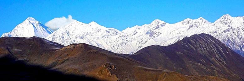
Annapurna Base Camp Trek Rapid is a picturesque walking journey that takes to the foothills of the Annapurna South. It is also popularly called Annapurna Sanctuary Trekking. Trekking to Annapurna Base is highly recommended for those who love to explore the rich cultural diversities, typical Nepalese villages, enjoy the flora and fauna and enjoy the panoramic view of Annapurna and Dhaulagiri Himalayan range.
The extraordinary variety of ecosystems is compressed into two weeks of Annapurna Base Camp trekking. The Annapurna south-facing slope of the base camp is covered with dense of the tropical jungle of rhododendron and bamboo. On the other hand, the alpine region above 3000 m in the north offers a dry rain shadow area with a colder climate similar to the Tibetan plateau.
What makes this trek very interesting
One of the best adventure treks in Nepal, Breathtaking mountain scenery, Dramatic sunrise view from Poonhill, Natural gorge and waterfalls, Great cultural diversity in the mid-hill region, Opportunity to explore flora and fauna.
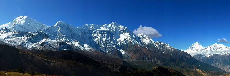
Ghorepani PoonHill Trek is an easy holiday hike in the Annapurna region. Ghorepani Poonhill Trek is very popular among travelers especially for the first-time trekkers who are looking for a few days to be close to nature and want to experience local culture in Nepal without involving in serious ascents. There is no risk at all of the high altitude sicknesses on this trek. Taking the steady pace through the beautiful Modi river valley, you gently climb up to Poon-hill, which lies at the foot of the Annapurna massif.
While trekking, you will enjoy each and every moment sighting at splendid Himalayan Mountain views of Dhaulagiri, Annapurna South(7219 m), Machhapuchhre( Fish Tail) (6997 m), Manaslu and other snow-clad mountains and experience culturally rich multi-ethnic villages along the route.
From Kathmandu, we drive to Pokhara following the Prithvi Highway and the next morning we further drive from Pokhara to Nayapul, the trek starting point. Leaving Nayapul you will walk along the Modi River passing through a forest of rhododendron and reach Tirkhedhunga village. The next day you climb for 2hrs uphill through Ulleri and Banthanti villages and reach the top of Nangethanti Hill. Then, you will descend from Nangethati to Ghorepani and stay overnight at the teahouse. Wake up at the break of dawn and hike to Poon Hill for a sunrise view over the Himalayan Mountains. . From Poon Hill, you walk down to the teahouse and have breakfast. Then, walk down to Ghandruk village. This is a very popular traditional village of Gurung ethnic groups of people where you can experience their age-old traditions and culture and interact with the local people. After spending one night at Ghandruk village you will retrace the route to Nayapul and catch the land transport. You will meet many fellow trekkers all along the way during the trek.
The best time to do Ghorepani PoonHill trek is Spring ( March-May ) and Autumn ( Oct.-Nov.). The blooming of Rhododendron starts in March. The trails can get slippery in monsoon or when the snow melts during early spring.
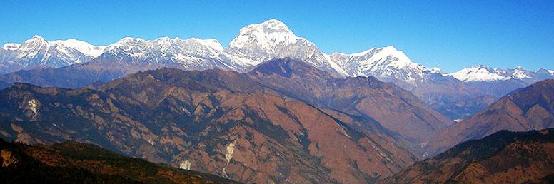
Jomsom Muktinath & Ghorepani Trek, is one of the easy treks in the Annapurna region. The journey to Jomsom Muktinath kicks off from Pokhara with a one-hour drive to Nayapul and makes relatively little uphill climb to Tikhedhunga (1540m) and walk to Ghorepani. We wake up early in the morning at Ghorepani and hike to Poon Hill (3210 m), the best view point to see sunrise in the morning. Besides, from Poon Hill we also enjoy wonderful view of mountains that include Mt. Dhaulagiri and Mt. Annapurna I, Annapurna south, Mt.Machhapuchhapure (fishtail), Mt. Gangapurna, Lamjung Himal, Barasikhar, Nilgiri, Tukuche Peak, and Mt. Hiunchuli and with dozens of other peaks.
From Ghorepani we walk down to Tatopani (Natural hot spring) and take natural hot bath. Then, we continue our walk through Ghasa and Marpha up to Kali Gandaki, the deepest gorge in the world and finally the trail emerges into wide valley of Jomsom. At the lower altitude we find rhododendron forests but at the higher altitude the landscape is dramatically changed into the arid desert like plateau similar to Tibet. Jomsom Muktinath is, indeed, a classical trek that follows Kali Gandaki valley between two big mountains- Annapurna and Dhaulagiri.
Jomsom Muktinath trek is suitable for those who are interested in experiencing the lifestyle of the mountain people, their ancient culture and diverse landscape. While trekking, you will encounter with caravan of donkey and ponies traveling to Mustang and other areas in the far north of Nepal. The final goal of Jomsom Muktinath trek is to reach Muktinath (3,800 m).The temple of Muktinath (3,800m) with 108 water spouts flowing holy water from taps and mysterious natural gas fires that surprises every visitor. This temple is very much sacred to both Hindu and Buddhist Pilgrims coming from different parts of India and Nepal. After visiting Muktinath Temple we further walk downhill to Jomsom, along the trail we enjoy with the beauty of the Dhaulagiri Glacier gleaming to the north. On the concluding day of the trek we take either a flight from Jomsom to Pokhara or can drive straight up to Pokhara. This is lodge trek ideal for those people who are not experienced in trekking in Nepal or having limited time to do a longer trek in the Annapurna region.
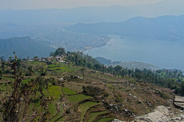
Sarangkot Australian Camp Dhampus Trek is one of the short and popular cultural treks in the Annapurna Region. This trek takes you through beautiful villages inhabited by mid-hill tribes called Gurungs, many of them are in Gurkha regiments working for British and Indian armies and some are engaged in agricultural farming. While on trek you will enjoy close up view of Mount Machhapuchhre ( Fishtail) and Pokhara Valley including Phewa Lake from the top of Sarangkot hill. You can see also Mount Dhaulagiri and Mount Hiunchuli in the far west. The whole of Annapurna Himalayan range is visible in a good weather.
Sarangkot (1592m) lies approximately 5 km from Lake Side in Pokhara. Sarangkot is popular as the highest viewpoint for sunrise and it is easily reachable to the hill top by land transport. . Many tourists visit Sarangkot for sunrise view and return to Pokhara after few hours stay. Paragliding from Sarangkot can be a truly wonderful experience for the adventure enthusiasts. You fly in the sky at least 30 to 45 minute flight sharing space with griffin vultures, eagles, and float over tiny villages, monasteries, lakes and jungle experiencing a spectacular view of the Himalayan Mountain Range. There is no doubt that paragliding provides anyone thrilling experience with plenty of photographic opportunities.
In one day stay in Pokhara you can do a short day hike to Sarangkot and Dhampus. After Sarangkot you will head for Dhampus village through ethnic villages, rice field terraces and sparse woods. Having enjoyed face to face view of a long Himalayan Mountain range of Annapurna and other peaks you will reach Dhampus in 3-4 hours. You will enjoy the wonderful sunset view on the Himalayas in the evening and sunrise the next morning, the natural scenery that you observe from Sarangkot and Dhampus will be a lifetime experience. After one night stay at Dhampus village you will walk back downhill through scenic route and then board a vehicle for Pokhara.
Royal Trek is one of the best introductory treks in the Annapurna region of Nepal. It is an easy and short trek. The walking trail does not ascend to high elevation; it passes through the rice terraced fields, bamboo forests and steams on the way. Each night you will stay at teahouse/ lodges run by the local people. Meals are also served at teahouse/ lodges at the affordable cost. The name of the trek ‘Royal trek’ has been dubbed just because Prince Charles of Wales walked through this small hill in early eighties along with his entourage of ninety fellow trekkers. Since then, this trek has become so popular and many trekkers choose Royal Trek in their wish list.
This trek is much suitable recommended for family with younger children, newly-wedded couples, nature lovers and for those who are visiting Nepal for the first time for trekking. While on trek ,you will enjoy spectacular views of Mount Annapurna, Mount Dhaulagiri, Mount Manaslu and many other Himalayan peaks. The beautiful mountain scenery, the traditional lifestyles and unique culture of Gurung, one of the ethnic groups of Nepal and easy accessibility to this area make Royal Trek one of the best.
This trekking is not recommended for the raining season ( July to mid-September). October and November are the best months to do Royal Trek in Nepal as the monsoon has stopped, the sky is becoming clearer, the climate is getting colder and the Mountain views are eye-catching. When we compare to other treks in the Annapurna region, Royal trekking route is less touristy.
– See more at: https://trekhimalayan.com.np/asia/nepal/trekking-in-nepal/royal-trek-#sthash.9hi7DioK.dpuf
Tashi Laptsa Pass Trek is Nepal’s one of the most challenging and exciting Passes. It lies at the elevation of 5,755 in the isolated Rolwaling valley. The journey begins with a scenic drive from Kathmandu to the ancient trading town of Dolakha and same day trek to Shigati, a small rural hamlet past every day through beautiful indigenous villages past terraced fields, dense, gloomy primeval forests, and climbs over broad ridges enjoying wonderful views. It is a palpitating adventurous trek over dizzy suspension bridges, impressive gorges, and steep paths. We reach the Tashi Lapsa Pass (5755m) in the glaciated wilderness of the very heart of the Himalayas. The first part of the trek is totally off the beaten track and it requires full board camping. The second half of the trek begins just after we enter to Khumbu, the famous trekking area of Everest region. Here we will enjoy lodge facility with the best cuisines all along the route till Lukla. From the thrilling elevated airport of Lukla, we exit out of Everest region flying back to Kathmandu.
You will enjoy the stunning mountain scenery including Mt.Gauri Shankar (7145m). Mt. Tengi Ragi Tau (6943m), Mt. Bisphero Go Shar (6729m), Mt.Dragkar Go (6793) and many other snowy peaks. After Tashi Laptsa Pass we enter the Khumbu valley, homeland of the Sherpas. While trekking one will experience the mix of vibrant Sherpa culture and explore the remotest corners where no human settlements exist. After we leaving base camp early morning we climb to a high camp at about 5400 m. and then we will cross the Rolwaling Tashi Laptsa pass to enter the Khumbu region and proceed on to Thame, Namche Bazaar and end the trek in Lukla.
Trek to Tashi Laptsa Pass requires the special permit as the Rolwaling region is so wild and remote that not many trekkers have dared to get there. This trek is strenuous and requires physical fitness and basic mountaineering skills
The Rara Lake Trek is a mesmerizing journey through the remote and pristine landscapes of Western Nepal. It leads trekkers to the breathtaking Rara Lake, Nepal’s largest and deepest freshwater lake, nestled within the Rara National Park. The trail takes you through dense forests, charming villages, and lush alpine meadows, offering stunning views of the Himalayan peaks along the way. The crystal-clear waters of Rara Lake reflect the surrounding snow-capped mountains, creating a picturesque scene that leaves a lasting impression. This trek provides a rare opportunity to experience the unspoiled natural beauty and rich cultural heritage of this region, making it a must-do for nature enthusiasts and adventure seekers alike.
Trekking to Rara Lake in a far remote Trans-Himalayan valley of Jumla district in the Karnali region is a fascinating journey. If a traveler is looking for wilderness and solitude journey in Nepal, this trek would be an ideal option. The route is very much ‘off the beaten track’ and one can experience unique cultures, tradition and amazing scenery not similar to any parts of Nepal. This trek is named after a beautiful high altitude lake ‘ Rara’ surrounded by alpine meadows and forests of Pine, Juniper, and Spruce. In fact, the lake is five kilometers long and two kilometers wide and considered the largest lake in Nepal. Rara Lake is Nature’s Retreat to every senses– the sight, the feel and the smell that makes every trekker proud of being in this place. Heaven is a myth but Rara is real.
The views of magnificent snow-capped peaks (Sisne, Kanjirobe HImal) in the background are exhilarating. We cross over Ghurchi Lagna Pass at 3450m while heading towards Rara Lake and trek through a few ridges of 3000m elevation. This trek is fairly high and free from monsoon thunderstorms; the summer season is actually the best time to visit. During autumn season trekkers are rewarded with the abundance of alpine flowers.
Rara National Park is one of the best places in Nepal to see the natural habitats of different species of wildlife like Musk deer, Leopards, Ghorals, Tahr, Himalayan black bear, and the rare Red Panda. The park is also famous for bird watching, especially during the months of November to April when many species of birds visit during their seasonal migration. The journey to Rara Lake is accessible by flying to Jumla via Kathmandu to Nepalgunj and begins the trek.
Journey into the Grassland – Badimalika is one of the new trekking trails recently explored in Bajura district in the far-western region of Nepal. Here one can find the most beautiful landscape. This place is also popular for hiking in Spring and Summer. With the increasing tendency to explore a new trekking destination in Nepal, Badimalika is the perfect choice for the pleasure seeking traveler. One can relax oneself while taking in the breathtaking views of mountains and greenery, breathe in the crystal clear alpine air, and bask in the warm sunshine at the foot of inspiring mountains.
At any time of the day, round the year, Badimalika has a special attraction for anyone visiting this newly explored destination for the first time. Due to the beautiful landscape and rustic environment, it makes every trekker come back again and again to discover something extraordinary.
The major highlight of the trail is a visit to the temple of Badimalika which is perched on a hillock at the elevation of 4,200 meters. The place dons festive look during Janai Purnima festival in August. Thousands of people from different parts of Nepal and India visit the temple on this auspicious day. Bajura district is rich in terms of culture and tradition of local people. They perform different dances like Deuda, Bhuwo, Hudkeuli, Thadi and so on. The trail to Badimalika is open throughout the year. But only in winter heavy snowfall can affect trekking. There are some basic teahouses available in lower parts of the trekking trail. However, trekkers are strongly suggested to be self-sufficient on food and accommodation. No special permit is required for trekking.As the area is relatively new, trekkers must hire local guides because there are no signposts and other infrastructures along the trails.

Kanchanjunga Base Camp trek is off the beaten trail which takes you to the base camp of the world’s 3rd highest peak – Kanchenjunga to the north-east part of Nepal. The entire trekking area is renowned for having the most pristine wilderness found on the planet. The biodiversity of the Kanchenjunga region is equally impressive as it showcases a number of natural & cultural significant landmarks, including indigenous villages, centuries-old monasteries, and more than 2,500 species of flora & several endangered wildlife species.
We start our trekking journey with a domestic flight from Kathmandu to Biratnagar and then drive up to Suketar. From Suketar we walk through great rhododendron forests & lovely villages of Chirwa, Sakathum, Amjilassa, Kyapra, Gunsa, Khambachen until we reach Kanchenjunga Base Camp at the elevation of 5220m. On the way, we cross over high passes & glaciers where we enjoy overwhelming views of the Himalayan giants that rise all around. After Ghunsa it takes another four days before reaching the north side base camp of Pang Pema (5100m) with fantastic views of Makalu, Chamlang, Everest, Jannu and the Kanchanjunga massif in the background. The views are stunning both from the Base Camp as well as during entire trekking. A special trekking permit is required to do the trek in Kanchenjunga region. The latitudinal variation and contrast between jungles and glaciers with some of the world’s highest peaks makes. Ethnic cultures are well preserved. Hinduism is the main religion of the local inhabitants of the region.
Milke Danda Rhododendron Trek takes you to Makalu-Kanchenjunga Region in the far eastern part of Nepal. It is a beautiful walk through a region of undisturbed floral beauty, forest landscapes, and stunning Himalayan wilderness. Milke Danda is a 25 km long, high forested ridge that splits the Arun & Tamur River Valleys. It is situated between the elevations of 2580 m and 3580m. The ridge has a great ecological variation encompassing the forests to alpine vegetation and is popular for having the highest diversity of Nepalese Rhododendron species. Recently, an agreement has been reached among the local people, conservationists, and the government agencies to conserve this beautiful remote area and it is a real privilege to be able to experience it.
Milke Danda Rhododendron trekking journey starts with a direct flight into Biratnagar and drives to Basantpur. Next morning we begin the trek to Milke Danda via Chauki exploring the pristine jungle environment of Gupha Pokhari, with magnificent mountain views of four of the world’s highest peaks. Along the trail, we visit different indigenous settlements of Buddhist Sherpas, Hindu Brahmins and Kirat Rai living in communal harmony. During the trek, one can experience about indigenous people’s lifestyle, diverse cultures, socio-economic situation and a complete sustainable eco-trekking of the Makalu-Kanchenjunga Region.
Those trekkers who wish to explore isolated parts of Nepal, Milke Danda Rhododendron trek would be the best. From March to May ( Spring) and September to December ( Autumn) are the best time for Milke Danda trek but one can also do this trek a year round except monsoon ( July- August)
If this proposed itinerary is not suitable for you, we will design similar one as per your interest and duration of holidays. Please feel free to contact us.
Kanchenjunga Jaljale Trek is one of the most pristine wildernesses to be found in the Himalayas. The name of this trek has been named after the lowest Himal of the Kanchanjunga The trekking route to Jaljale was opened in the spring of 1988. Even today we rarely see any other trekkers along this route. However, it remains the most pristine wilderness areas in the Himalaya.
We begin our trip with a flight to Tumlingtar and then trek to Kharang Bazaar, where we can visit a weekly market held every Friday. Next day morning we gently ascend Milke Danda that lies across JaIjale Himal. With its highest point just over 15,000ft Jaljale is the lowest Himal in the range. It is a long, spiny mountain, stretching north-south for over 25 miles, with rugged rock formations rising above clear alpine lakes. While the net elevation change each day is minimal, the terrain, elevation, and remoteness are challenging. We next travel to the rarely visited town of Topke Gola 13,000ft, on the banks of the upper Mewa (Papaya) River. It is inhabited by Tibetan traders and yak herders. As we descend the river, we experience greener, warmer and gentler terrain. Shops selling local green tea and Tongba (fermented millet alcoholic drink) offer additional opportunities to interact with the local people. We end our trek at Basantapur and drive back to Biratnagar and catch the flight to Kathmandu.
The Jaljale Himal trek can be undertaken by any trekkers but requires trekking experience, as some parts of the trail need to be ascended across the ridge and seems to be quite difficult. With the help of our experienced guides and Sherpas, trekkers with limited experience we can organize this trek safely and comfortably.
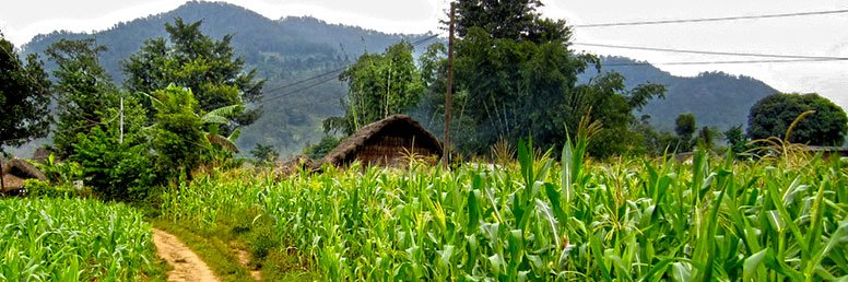
Makalu Base Camp Trek is one of the most popular among adventure seekers. Trekking to Makalu Base Camp offers an exceptional opportunity to explore high-altitude terrains, snow-bound landscapes and encountering with ethnic Himalayan people. The trail follows through the Makalu Barun National Park & Conservation Area which is replete with pristine forests, alpine meadows & endangered wild life of Makalu region. While trekking, we experience a wide diversity of ecosystems and different ethnic cultures and traditions at various places where we tread on. In addition, we rejoice with the spectacular sights of Mount Everest, Mount Makalu, Mount Lhotse & Mount Chhamlang. The Makalu Barun Valley inhabits very few people.. Very few foreign trekkers visit this area due to remote wilderness & inaccessibility. Trekking to Makalu Base Camp is an unforgettable experience for those wanting a true adventure in Nepal.
The journey to Makalu Base Camp begins with an hour-long flight to Tumlingtar where from we start trek to Chichila. The lower reaches of the trail are renowned for its lushness with verdant rhododendron forests whereas the upper reaches of the trail comprises of polished granite cliffs capped by hanging glaciers, overflowing with waterfalls. The 22-day Makalu Base Camp Trek is an ideal choice for avid trekkers and nature enthusiasts who seek solace and tranquility in pristine natural habitat and those who wish to avoid crowds.
The itinerary for Makalu Base Camp has been carefully planned to allow trekkers for proper acclimatization to the high altitude, and sufficient time in the area of “low” base camp for further exploration to high base camp at the foot of the Chago Glacier, and for those who wish, a climb to a view point at the elevation of 6170m.
For passionate trekkers and nature- lovers who desire to keep away from crowds and seek peace and solitariness in pristine natural habitat, Makalu Base Camp Trekking is highly recommended.
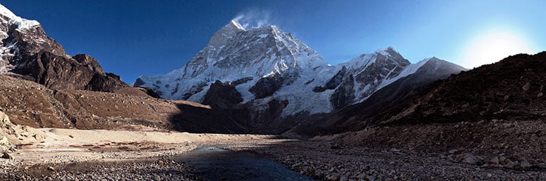
Makalu – Sherpani Col Trek is incomparable trekking route traverses a spectacular, seldom visited region of Nepal and crosses three High Mountain passes. On the final section, the route meets the popular southern approach to Everest Base Camp at Chhukung. The rare views are some of the most breathtaking in the whole Himalayan range: around you are vistas of three of the world’s five highest mountains: Makalu, Kanchenjunga & Everest.
Makalu – Sherpani Col Trek starts form Khandbari and takes us through the secluded villages to the Khongma Pass, allowing much needed acclimatization. Beyond Num there are no villages. The ultimate challenge is after the Makalu Base Camp as we cross three high passes – Sherpani Col (6135m), West Col (6143m) and Amphu Laptsa (5850m) to reach Chhukung. Of all the great walks in the world, this is one of the most spectacular and rewarding.
This adventure requires toughness as well as the ability to travel on ice and snow. Sherpas will guide the route and ensure safety, but trekkers must be capable of walking with crampons, ice axe, harnesses and ropes.
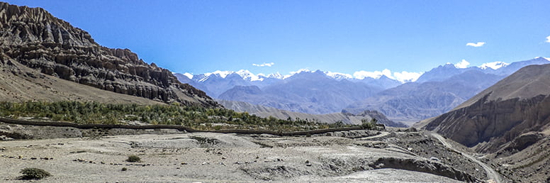
Upper Mustang Trek is one of the most popular regions for trekking in Nepal. It lies north of the Annapurna region just behind Mount Dhaulagiri and Mount Annapurna massif very close to the Tibetan border.
Geographically Upper Mustang has long been isolated from the outside world and only recently opened to trekking groups. The trek to Upper Mustang begins with a flight to Jomsom from Pokhara where we make our way through a quaint medieval town of Kagbeni, brightly painted chortens (Buddhist shrines) and tiny villages guarded by enormous monasteries.
While walking along this barren land our collective minds are blown with great views of the snow-covered Himalaya to the south, and desolate high plateaus, deep canyons and an ocean of windswept hills exploding with the colors of the sunset on the desert to the north. Once we reach the walled capital city of Lo-Manthang, we’ll absorb in a great sense of timelessness and appreciation of the ancient culture as we discover the ruins of old forts and monasteries rich in art and history plus caves replete with magnificent religious statues. While visiting at Kagbeni (2,858m), Syanbochen (3,475m) on the way Lo-Mangthang (3,810m) you will find the living images which reflect the society of the primitive time. Most of the places along the trail offer you to enjoy the magnificent views of Himalayas before our eyes.
Those who love to explore ancient villages and experience the cultural and natural diversity of the Buddhist land in Nepal can join our 19 days exotic trip. If you are looking for Tiji Festival in Upper Mustang, the month of May will be the best. The great festival is held on the premises of the Mustanghi king’s palace in Lo Manthang. Despite monsoon in other parts of Nepal, we can organize trekking during June, July and August.
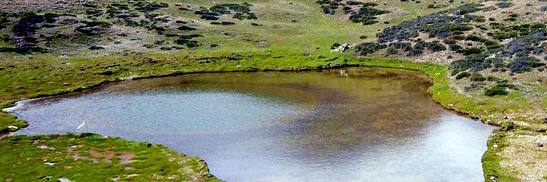
For those seeking the outer remote edges of Nepal, the Mustang region is an ultimate destination. This is an ancient Himalayan Kingdom which lies in the northern central part of Nepal and at the top of the Kaligandaki River. This area is considered one of the most interesting and picturesque destinations in the country.
The whole area is isolated, quite remote and mystical to the visitors. Damodar Kunda, the most fascinating high altitude lake (4890m), lies in Upper Mustang and eastern south of Lo-Manthang. It is a new trekking route opened in 2002 for Hindu & Buddhist Pilgrimage groups & international tourists. One who does this trek will feel heavenly pleasure of being near Damodar Kunda Lake at the foot of Annapurna Range.
Upper Mustang and Damodar Kunda Trek is highly recommended for those Pilgrims who want to make the trip during the full moon of August to celebrate a big festival. To visit in Festival time gives an immense experience, the views are great, and there is an opportunity to climb up some of the hills while on the trek. You can see the Tibetan plateau & Damodar, Himal to the north and the Annapurna Himalayan massive to the south
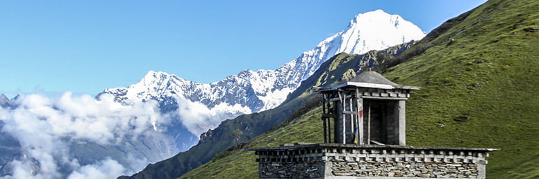
Ruby Valley Camping Trek is a newly explored trekking route that passes through Dhading, Gorkha, Rasuwa and Nuwakot districts of Nepal. This trek is named after the precious Ruby stone as this hidden valley is considered to be Ruby stone mine sites. The trek offers a unique experience of mountain, culture and natural biodiversity of the remote areas. The highest altitude of Ruby valley trek is Ganesh Base Camp (3250m). During the trekking journey, one can visit Black and White (Kalo-seto kunda) lakes originated in a melted glacier. Crossing Sing La pass (4040m) and catching hold of a panorama view of the Himalayas is a lifetime experience one can’t miss. During the trek one can see Mt. Ganesh I, Ganesh II (7118m), Lapsang Karbo (7043m), Pabil (7,104m), Mt. Manaslu and Langtang, in a clear weather condition.
Ruby valley Trekking can be organized in different durations depending on starting and ending point. It is mainly full board camping trek but home-stays can also be arranged. Very few trekkers have visited this off-the-beaten track. We will walk through the various settlements populated mainly by Tamang Gurung and Ghale to the north, and, Chhetri, Bramhin, Newar, Dalit and Chepang at the lower altitude to the south. However, Tamang who are Buddhists form the majority settlers. Many Buddhist monasteries and Hindu temples can be visited during this trek.
As the trekking route encompasses both Langtang National Park and Manaslu Conservation Area, this area is home to rich biodiversity. Every spring especially March,April and May the hillsides and forests are covered with various species of rhododendron flowers, pines, oaks and may herbaceous plants. The landscape is dotted with rivers, streams, waterfalls, and lakes.
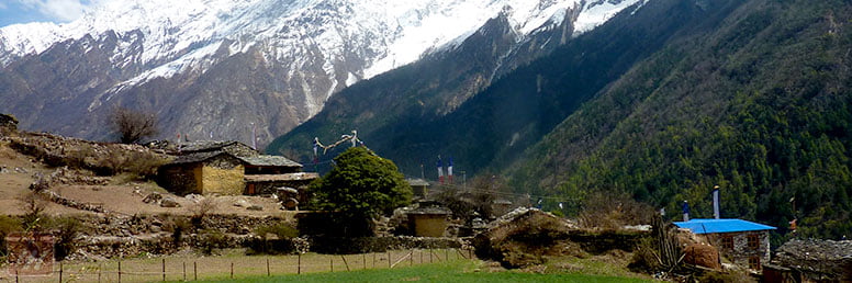
Tsum Valley is a beautiful Himalayan valley situated in northern Gorkha, Nepal. Against the majestic backdrop of the Ganesh Himal and Sringi Himal, and Boudha mountain ranges, this serene Himalayan valley is rich in ancient art, culture and religion. The Tsum Valley is bounded by three high passes- the Ngula Dhoj Hyang (5093m) to the west and Yamdro Pass (5326m) to the north. Trekking trail to Tsum Valley is spread out with beautiful chortens and dotted with mani walls carried with sketches of deities and inscribed with prayers. The local people are immigrated from Tibet long time back and speak unique dialect. They follow Bon religion. The trek starts at Arughat and the trail follows the serpentine Budi Gandaki River until it reaches the plateau-like Tsum Valley with magnificent views of the Ganesh Himal and other mesmerizing peaks.
Tsum Valley Trek is accessible via two routes: one passing through Chumchet and another from Lokpa. Both the routes entails steep uphill climb of over 1500 m. from the surface of the valley. Due to its remoteness and difficulty for trekking, this sacred valley and its people have been isolated from mainstream of development for centuries. As a result, the extraordinary culture of this valley has remained intact. The valley is enriched in wildlife, especially the Himalayan Thar and Blue Sheep which flocks in herds of 50 to 200. Hunting, fishing is not prohibited in the Tsum Valley. The valley also brags some ancient and historic monasteries, that includes Rachen Gumba (3360m) and Mu Gumba, which perch on a small plateau situated in the lap of the valley, and Gumba Lungdang, situated at the elevation of 3370m of a conical hill opposite to the main slope of Ganesh Himal. While on trek you will visit the biggest and most popular woman’s Monastery in Rachen Gompa and in Gumba Lumdang .Besides you will also visit another biggest Monks’ Monastery at Mu Gompa (3700m) and Milarepa cave where Milarepa is believed to have meditated, situated near the Rachen Gompa
Tea house or Home Stay facility is available in Tsum valley. Tea house trek to Tsum valley is comparatively least cost so that it is affordable for most of the trekkers. In tea house trekking, you will simply find accommodation and local foods.
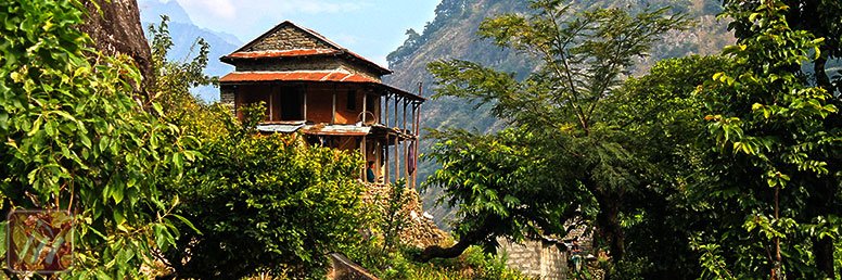
Manaslu Circuit with Sama Goan is an inspiring trek around Mt. Manaslu (/8,156 m ) the world’s 8th highest). It is truly an adventurous and challenging trek. You will walk through an “untouched” wilderness region of Nepal. The trail beyond the Budhi Gandaki is considered a most difficult in the Himalaya with huge ascents and descents (spanning altitudes from 375 meters to 5213 meters). For those seeking a real challenge, immense solitude, and ultimate views, this Manaslu Circuit with Sama Goan trek will meet the expectation.
The trail is rough and steep and at times hangs out high above the river. Being rigorous, this trek is wonderfully spectacular and culturally fascinating. The views of Manaslu and other neighboring peaks from Larkya La Pass (5213) will allure every climber.
Trekking to Manaslu Circuit begins from the Arughat bazaar, in the western part of Nepal following the upstream of the Budi Gandaki river. From Kathmandu, we take you on our private transport along the Prithvi Highway until we reach Malekhu bazaar. Thereafter we cross the Trishuli River and continue to drive about 17 km to reach Arughat bazaar.
From Arughat bazaar we walk through lush green lower hills inhabited by Indo-Aryan Hindus and cross the snow- bound Larkya La pass (5,213m). Larkya La Pass attracts every trekker. This Larkya La Pass separates the Manaslu and the Marshyangdi River valley. Larkya La Pass offers spectacular views and it is quite interesting. Trekkers should be physically most fit and mentally well prepared. The Manaslu Circuit trekking offers a superb alpine experience to those seeking true adventure.
Sama Gaon is a beautiful village of Mani walls, household monks, Gompas , narrow dirty alleyways with stone houses. One can visit Pema Choling Gompa. The income source of people of Sama Gaon is based on farming, herding, and trading. One should spend at least one extra day in Sama Gaon
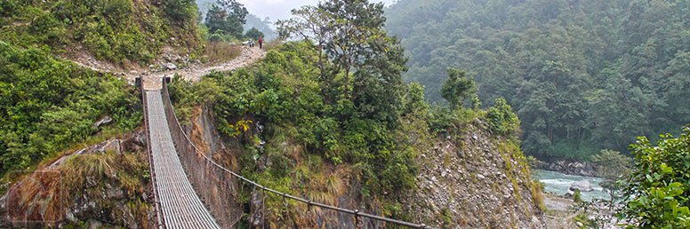
Manaslu Rupina La Pass Trek is one of the challenging treks in Nepal. Rupina La Pass trekking route was only officially opened for tourists in 1991. The entire Manaslu region is geographically spectacular naturally and culturally due to the gorgeous Himalayan scenery, lush valleys, beautiful landscapes, diverse flora and fauna and mix ethnicities. During the trek, one can enjoy the Tibetan culture with the lifestyle of the people.
When you walk through typical ethnic villages to northward delightful valley and alpine meadows you will reach to beautiful Tibetan-style villages. As you walk up the hill each day you will feel the geological variation impacts on cultural aspect. When walking to higher altitudes you will not feel the humid temperature of the lowlands.
You will start Manaslu Rupina La Pass trek from Barpak, keep walking through the well-preserved countryside and heading towards Rupinala (4670m) pass, where the trail emerges into the wilderness for several days before coming down to Budi Gandaki River valley. As you gain altitude, the valley ultimately gives a glimpse of the wonderful cluster of villages and mountain pastures beneath Mount Manaslu’s extensive North Face. The trail reaches Samagaon, the main and important village on the expedition route to Manaslu peak and trekking route to Manaslu. During the trek, you don’t see any other trekkers for the first ten days while making the circuit of Mount Manaslu via Rupina La. After crossing both Rupina La Pass we walk down the Marsyangdi valley and follow the Annapurna circuit trail and take a land transport from Arkhet to Kathmandu via Beshisahar and thus conclude the trek.

Manaslu Base Camp Trek with Larkya Pass refers that you make a complete round the world’s eight highest Mountain Manaslu (8163 m) before crossing Larkya Pass. Trekking to Manaslu region is wild and remote, yet there are teahouses available every day.
Manaslu Base Camp with Larkya Pass is one of the classic treks in Nepal. The trail beyond the Budhi Gandaki is one of the most difficult routes with huge amounts of ascent and descent as you trek up and down over ridges and onto shelves to bypass cliffs. The trail is rough and steep and at times literally hangs on a buff high above the river with its many bridges. This trek is geographically spectacular and culturally mesmerizing. The views of Manaslu and other neighboring peaks from Larkya La Pass are beyond tantalizing.
We begin our journey at Arughat Bazaar and follow the meandering Budhi Gandaki River northwards to the village of Deng. As we walk further northwards the valley opens up to reveal the delightful alpine meadows and small Tibetan-style villages which cluster beneath Manaslu’s sweeping North Face. We pass through Deng, Ghap, Lho Gaun and Sama Gaun all typical Tibetan villages with rows of small revolving prayer wheels used by Tibetan Buddhists and a wall of mani stones positioned in the middle of the trekking trail.. It brings a good luck when we spin the prayer wheels being stood on the right side. Our trekking guide will interpret the things along the trail.
After we reach Samagaon, the largest and most important village in the region, we visit Samagaon Gompa and next day we do excursion to Manaslu Base Camp (4,665m) before heading west to cross the Larke Pass (5135 m),
It is truly a classic and tough route linking the Budhi Gandaki with the Marshyangdi valley. From Samagaon and Larke Pass the views of the base camp of the Mount Manaslu look fantastic. Our porters will carry your bag pack and you just enjoy taking photos or chatting with locals along the trails.
Our descent passes through the beautiful alpine meadows at Bhimtang before we join the main Annapurna Circuit route which takes us out to the trek ending point at Bhulbhule. From Bhulbhule we drive back to Kathmandu via Beshisahar.
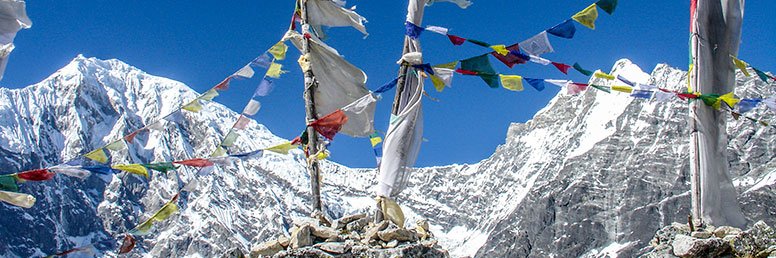
Langtang – Ganja La Pass Trek takes you to the popular Langtang region and crosses the high altitude Ganja La pass. The climb to this pass on both sides is steep and the entire trip is an exciting adventure. We embark this adventure trek with a day’s scenic bus ride at first from Kathmandu to Syabrubesi and trek to Kyanjing Gompa. After Kyanjing Gompa we cross the challenging Ganja La pass, and ends the trek at Kakani in the Helambu region. You walk through a beautiful alpine valley before reaching Kyanjing Gompa. There we allow you two full days to explore the glacier of the valley and then we head to Tarke Gyang and Kakani in the Helambu region. On the way we cross over the 5106m. Ganja La Pass which is usually obstructed by snow between December to March. Sometimes a sudden change in bad weather can make crossing this pass really dangerous. After crossing over the pass it takes you three days to reach Tarke Gyang. There is no permanent village in between.
The climb to the pass on both sides is steep and the entire trip is an exciting adventure. For Langtang Valley – Ganja La Pass Trek we require experienced local guides and good equipments as there are no lodge accommodations between Ganjala Base Camp. Yak Goth and Dukpu and this is why groups with the accompanying staff must be fully self-sufficient. At the final leg of the trek , you will hike through some picturesque rice terraces and a few splendid Buddhist monasteries around the delightful villages
During the trek you walk through rhododendron and alpine forests exploring the head of the valley getting close to the glacier system. After we climb Ganja La Pass (5,200m )we enter Helambu valley. After visiting the area and enjoying the cultural blend of diverse ethnic Tamang and Sherpa people permanently residing in the area, we return to the place -Kakani and then get back to Kathmandu. In fact, the people living in the Langtang region are Nepalis by birth but , their descendants are of the Tibetan origin, as they look like Tibetan.
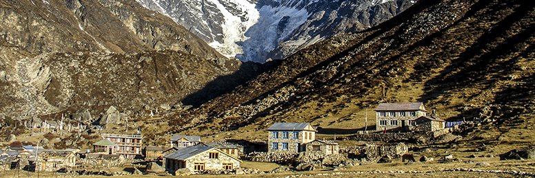
Langtang Gosaikunda Helambu Trek is a round trekking trail starting in Langtang Valley of Nepal heading to Gosaikunda Lake and ending in Helambu valley. This long trek is considered to be a non- technical and suitable for every trekker and age group. It covers three iconic trekking trails namely Langtang Valley, Gosaikunda Lake and Helambu valley all lie in the Langtang region north of Kathmandu valley.For every trekker it is the most effective way to explore the holy Lake Gosaikunda, Lurebina La Pass, Rhododendron forests and various species of flora and fauna along the route. During the full moon day in August thousands of Hindus and Buddhist pilgrims including the locals visit the sacred lake of Gosaikunda to pay religious homage every year.
The main attraction of Langtang Gosaikunda Helambu Trek is to view the blooming of rhododendrons especially in Spring and walk through bamboo forests sighting an abundance of wildlife, majestic waterfalls flowing over huge boulders, a chance to swim in the river, enjoy magnificent views of the snow covered Himalayan Mountain range. While walking through traditionally built ethnic Tamang heritage villages, one will experience local culture, way of life of the villagers and religious practices. Besides one will also get an opportunity to climb small peaks, visit Nepal’s oldest Cheese factory, glaciers and scared lakes along the route. Most of the trekking routes of Langtang Gosaikunda Helambu fall into Langtang National Park that offers pine and rhododendron forests, swift mountain streams, rugged rock , grassy sloping land and meadows strewn with alpine flowers. The way to Gosaikunda Lake climbs more steeply through farmlands above the tree line to that of an alpine ridge. While trekking to scared high altitudes lakes one can witness a beautiful Himalayan panorama. At Kyanjing one can experience the spiritual lifestyle of dedicated Buddhist monks who perform their rituals in a beautiful Monastery every morning and at the Buddhist festivals.
In the beautiful Sherpa land of Helambu one will explore the locally popular Tibetan monasteries and experience the Tibetan culture and tradition. Helambu valley is also as popular as Langtang valley for its natural beauty , wonderful climate , superb views of snow-covered mountains and friendly Yolmo also pronounced as Hyolmo tribes. They have their own language and follow Yolmo culture. . Langtang Gosaikunda Helambu Trekking could be the best trekking destination for those who want to enjoy natural landscape, distinct cultural practices along with bio diversity in the Langtang region of Nepal.
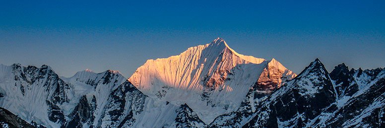
Helambu Circuit Trekking is a cultural trek to north of Kathmandu. It is a short and easy trek anyone can do. Helambu was long time before considered a hidden and inaccessible fertile valley. But now it is easily accessible by road up to trekking starting point. Despite the road connectivity most of the parts of Helambu are comparatively isolated and accessible by walking trails. Only few tourists visit Helambu valley. People of Helambu call themselves Sherpa, although their language, culture, tradition and the costumes of are not similar to those of Sherpa community of the Everest region. In Helambu valley we find many Tamang ethnic groups of people, while the lower parts of the valley are farmed by Hindu ethnic groups of people. While trekking one can explore rural life of Nepal, a great variety of wild flowers, snow-clad Himalayan peaks, apple orchards, Himalayan streams and artistic Buddhist monasteries. Langtang Himal is often visible, but the views aren’t as close-up as in other trekking regions of Everest, Annapurna and Langtang. However, the views observed from Tharepati on this trek are stunning. Helambu valley is also popular as a Buddhist pilgrimage site.
The highest point of the trek that one will reach will be only 3490m in our proposed itinerary, so acclimatization is hardly a problem. We have proposed Sundarijal as our trekking starting point but there are other alternative trailheads one can choose through Sankhu, Kakani and Nagarkot. To access the hills faster, one can take the Arniko Highway to Melamchi Bazaar via Banepa or Dhulikhel, and begin the trek towards both Thimbu and Sermathang.
Helambu Circuit Trek is highly recommended for those looking for a week long short cultural trek in Nepal. Come and join us to immerse yourself in the beauty of this trek.